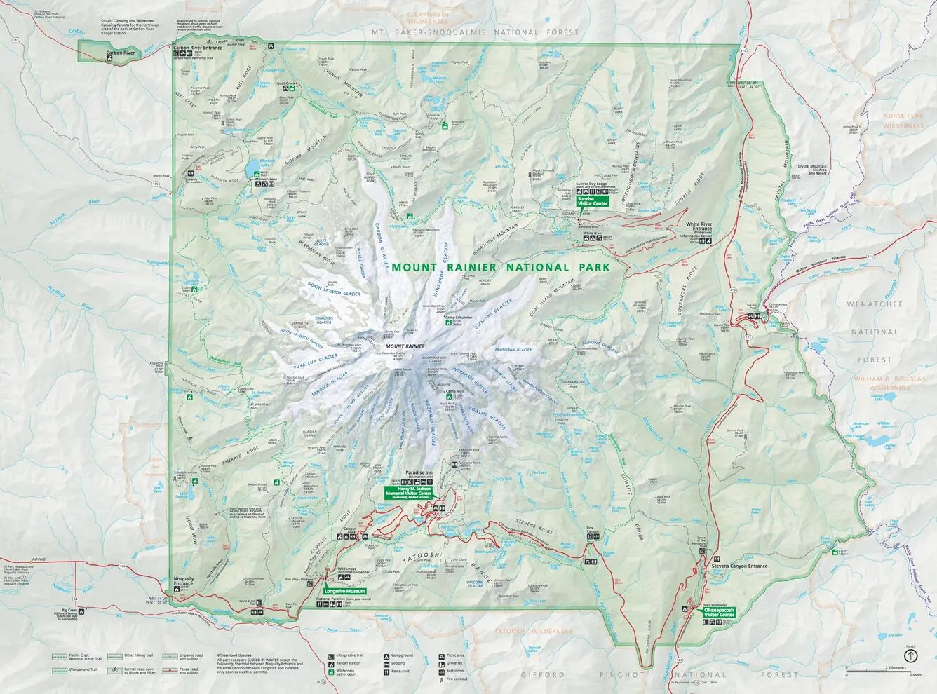
Mount Rainier National Parks Map
- 1:30000 Scale Illustrated Shadedrelief topographic map
- Hiking Trails Including the Wonderland trail
- Campgrounds, Backpacking campsites and visitor Facilities
- 7 major climbing routes to the summit
- 3 high elevation circumnavigation routes
- High altitude ski routes
- Waterproof and highly tear resistant materials
- 40 X 56 inches folds down to 5 X 8 inches

 Cart(
Cart(